By Clay Sisson, Albany Quail Project Director and Extension Coordinator and Karen Cummins, Geospatial Database Administrator
The Tall Timbers’ Game Bird Program needed an efficient way to track field visits on hunting properties both by program area and regionally to help maintain our partnerships with land managers and owners. The Tall Timbers Geospatial Lab had just the right tools for this undertaking. The Geospatial Lab developed an intuitive mobile app solution, so that the Game Bird Program staff can enter basic information regarding their visit, even in remote locations.
One of the benefits of the mobile app is that the user can just place a pinpoint on their location and the app will automatically generate the current data, name of property, as well as the region, so they can spend more time with the landowner and less time filling out forms. The data from the mobile app is then displayed in a ‘Regional Extension Activity Tracker Dashboard’ that summarizes their data into charts and lists, as well as an online map.
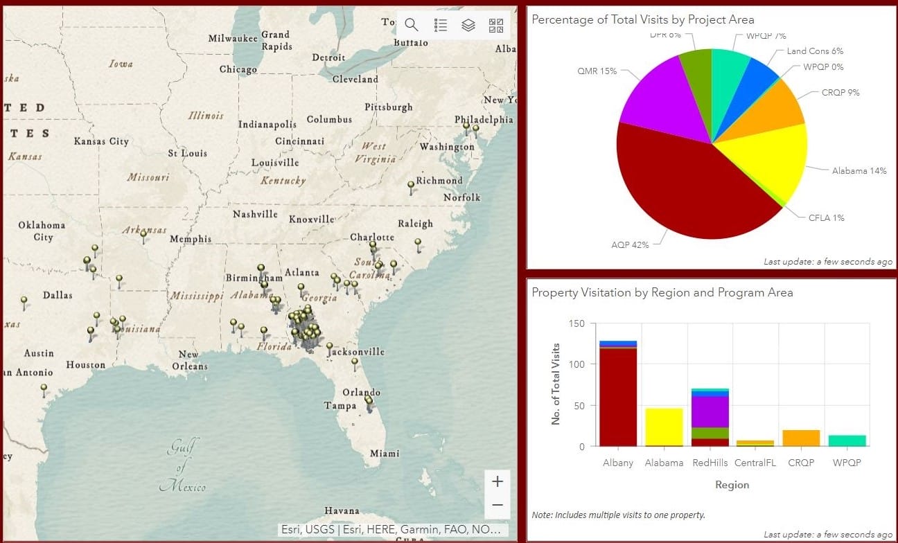
A section of the new app dashboard displaying a map of properties visited and the number of visits by region.
On the map, it’s incredible to see the range that the Game Bird Program covers – from Texas to Maryland, and down to Central Florida, as well as the density of coverage in the Red Hills and Albany regions. As of November, there have been 311 property visits in 2022 by Tall Timbers game bird biologists.
Clay Sisson, the Albany Quail Project Director and Extension Coordinator at Tall Timbers, can now just look at the Activity Tracker Dashboard on his phone and quickly assess if there’s been a recent property visit, so communication with landowners is much more efficient. The Game Bird Program can now easily assess where they haven’t visited as well, so they can touch base with these landowners and see if they need assistance.

Chart depicting property visits by Region and Program Area.
There’s also an interesting friendly competition that’s developed among the Game Bird staff members on who can visit the most properties. This is a great example of how the Geospatial Lab has supported other Tall Timbers’ programs and made them more efficient.