
eNews
Fall/Winter 2021 | Vol 14 | No 3
Southeast Prescribed Burn Permit Geodatabase
Prescribed fire is an important tool across ecosystems to reduce wildfire hazard, maintain fire-prone ecosystems, manage threatened and endangered species, and improve wildlife habitat. Increasing the pace and scale of prescribed burns for fuels management is a major priority to reduce wildfire intensity that endanger communities and disturb habitats. The purpose of the Southeastern Burn Geodatabase Project is to map and analyze the frequency of prescribed burns throughout the Southeast.
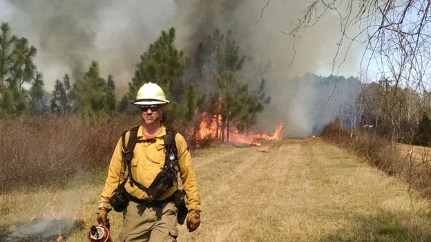
Photo Courtesy of the Prescribed Fire Training Center (PFTC).
Tall Timbers collected information on how permit location is tracked in the Southeast including what attributes are collected, spatial characteristics, period of record, and data stewardship. Prescribed burn data was then requested from twelve Southeastern states for the 2010-2020 time period, which was then loaded into a database with standardized minimal attributes.
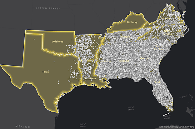
Prescribed burn data collected from the Southeastern states.
Tall Timbers is using this data for a multi-state database, with timely and informative burn data throughout the Southeast United States. This database could also be used by public and private land managers to prioritize areas for treatment with prescribed fire, as well as by scientists and policy-makers, to help answer a variety of questions as we all work to expand the pace and scale of prescribed fire use.

Heat Map of all Burn data (2010-2020) in the Southeast showing the density of burn points, weighted by acreage.
While there are limitations to this data, the burn authorizations are a rich dataset, which can be used in a spatial database as ancillary data for analyses that will further our understanding of prescribed fire occurrence and characteristics. The ultimate goal is to assist prescribed burn practitioners to make better decisions in prioritizing areas of treatment. Capturing the prescribed burn patterns in each of the Southern states may reveal patterns of opportunities and limitations—time of day, seasonality, topography, and cultural preferences.
Learn more about this project at the “Community of Fire” Story Map. Please contact Karen Cummins for more information.
Special Thanks go to: Alabama Forestry Commission, Arkansas Forestry Commission, Florida Forest Service, Georgia Forestry Commission, Kentucky Division of Forestry, Louisiana Department of Agriculture and Forestry, Mississippi Forestry Commission, North Carolina Forest Service, Oklahoma Forestry Services, South Carolina Forestry Commission, Tennessee Division of Forestry, Texas A&M Forest Service, Virginia Department of Forestry, Fort Benning, and Kisatchie National Forest.


