
eNews
Spring 2019 | Vol 12 | No 2
Using LANDSAT Burned Area Products to Map Fires Across Florida
Tall Timbers staff recently completed a collaborative project that mapped the footprint of fire across the state of Florida. Florida leads the nation in prescribed burning accomplishments with between 1-2 million acres of prescribed fire approved annually (approximately 10% of total fire area burned nationally). This is especially impressive as nearly 70% of the state is in private ownership, and accounts for many of these fires. Florida has had a method for tracking the permitting of fires for over a decade. The Florida Forest Service requires prescribed burners to submit a request to burn to an Open Burn Authorization (OBA) system. Approved burns are tracked, including information such as size, date, time, and purpose. However, the fire locations are recorded as points, and more than one ‘burn unit’ can be associated with a single OBA point. This can be an issue for conservation and management prioritization purposes, where actual spatial area information about fires may be required.
The goal of this project was to utilize satellite-based data products to derive the spatial extents (e.g., boundaries) of burned areas in Florida in order to show the extent of fires across the state. We used the USGS LANDSAT Burned Area (version 2; BAv2) products to map burned areas for the period 2006 to 2018. Datasets provided by public and private landowners around the state were used to corroborate the products and improve upon them; meetings showing the products to land managers were very useful – land managers provided suggestions on where fires were being mapped accurately as well as when and where there were challenges.
We mapped fires greater than 2.5-acres across the state. You can see how the different methods of displaying fire history data vary and the utility associated with each method (Figure 1).
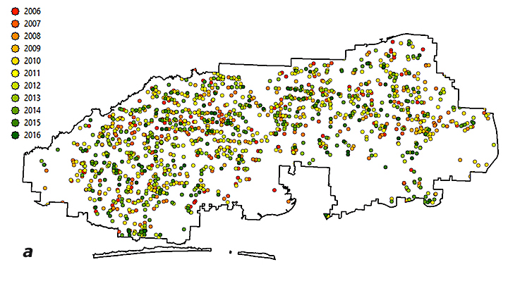
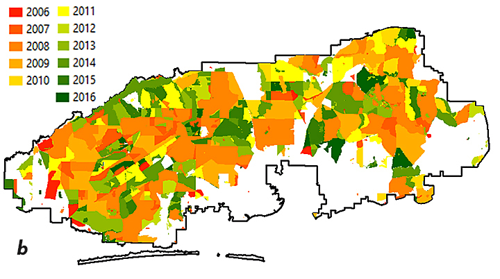
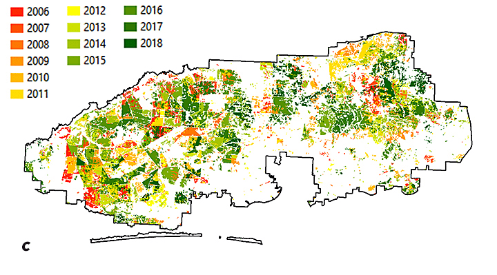
Figure 1: Maps using different data sources to show “year last burned” on Eglin Air Force Base. FFS OBA data for 2006-2016 depict the amount of burning, but not the location (a); landowner provided fire history shows units where fire was applied and when (b); BAv2-derived fire extents show where and when a fire was detected, including the mosaic within a burn unit (c).
Perhaps the biggest benefit of this process is that fire history metrics were calculated for all areas in the state, no matter the administrative/ownership responsibility. These metrics include season of burn, number of times burned, longest fire-free period, year last burned and time since previous burn. These types of metrics allow for conservation and management prioritization activities — some of which are heavily influenced by an area’s fire history — to be evaluated in a robust manner (Figure 2).
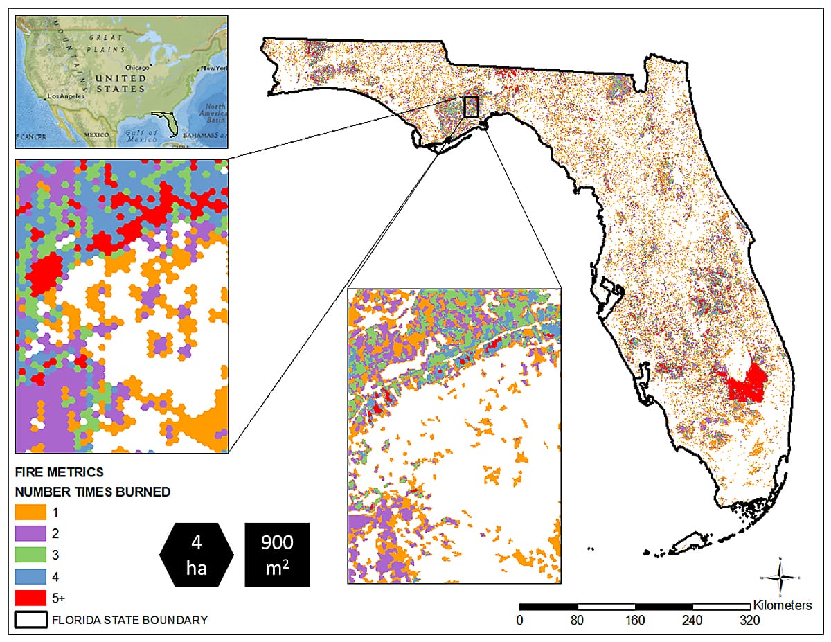
Figure 2: Number of Times Burned within each 10-acre (4-ha) cell between 2006 to 2018. We mapped all fires, but the 30-m resolution that the 2.5-acre fires are mapped is difficult to see at the state level, so we display them as ‘summaries’ over a larger area in order to highlight areas of interest. From there, a manager can zoom in to the actual 2.5-acre mapped data to determine specifics on what is happening on a given piece of ground. The comparison is shown in the two boxes.
We extend our thanks to the Florida Fish and Wildlife Conservation Commission and the Peninsular Florida Landscape Conservation Cooperative for funding, the US Geological Survey for data acquisition and processing assistance, and the many public and private landowners that provided burn history data for use in validating these products.
If you would like information on how to work with Tall Timbers for your area of interest, or have suggestions for other fire history metrics that would be of interest, please let us know. We want our products to be useful in the field! You can contact Casey Teske (cteske@talltimbers.org) or Joe Noble (jnoble@talltimbers.org) for more information about the fire mapping outputs. More information about the USGS Burned Area products can be found on the USGS website: https://www.usgs.gov/land-resources/nli/landsat/landsat-burned-area.


