
eNews
Summer/Fall 2021 | Vol 14 | No 2
Using Terrestrial LiDAR to Survey Habitat Conditions
For the second summer in a row, Tall Timbers collaborated with the US Fish & Wildlife Service (FWS) to collect terrestrial LiDAR data and examine its use as a field monitoring technique. This interagency terrestrial LiDAR project dispersed six fellows across three states in the southeast region to gather data. These locations included St. Marks National Wildlife Refuge (NWR) (St. Marks, Florida), Piedmont NWR (Hillsboro, Georgia), and across the Francis Marion & Sumter National Forest ranger districts (South Carolina). The data collected will not only benefit those sites, but will also allow for a refinement of the overall protocol and development of the capabilities of the technology. This new surveying method will provide a range of data and products that will aid in land management decisions, as it can monitor landscapes rather than isolated ecosystem properties.
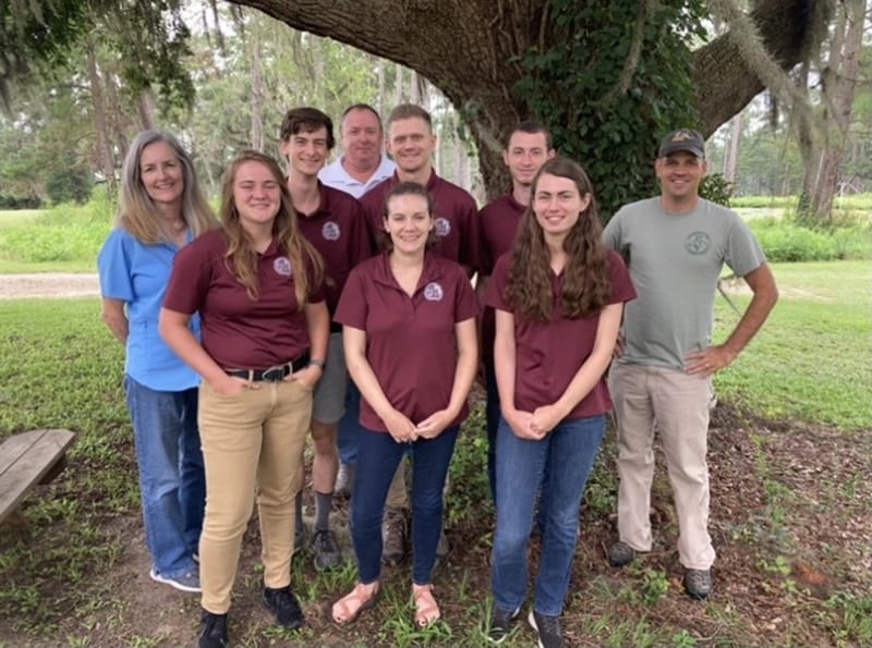
US Fish and Wildlife LiDAR monitoring field team including FWS Directors Fellows; Top left Laila Lienesch, Hugh O’connor (Fellow), Jon Wallace, Evan Monnet (Fellow), Konnor Larkin, Scott Pokswinski; Bottom left Jennah Ruebens (Fellow), Molly Dixon (Fellow), Calista Hnilica (Fellow).
The fellows were given this opportunity through the Directors Fellowship Program. The program provides college students, both undergraduate and graduate, experience working on projects that promote and support the conservation priorities of FWS.
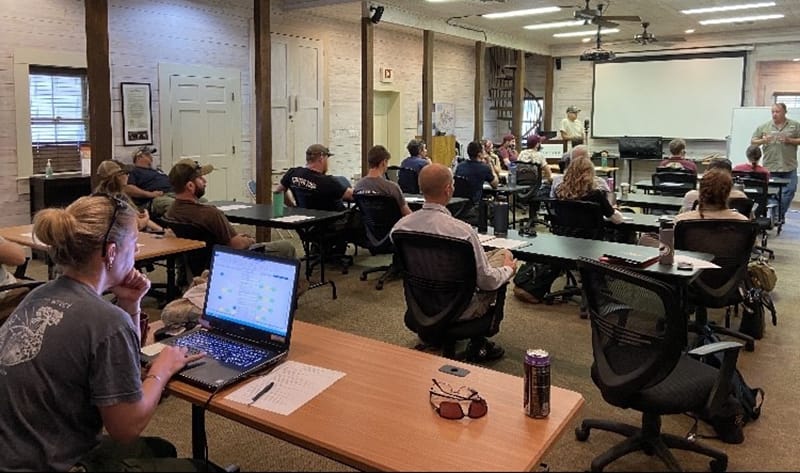
US Fish and Wildlife and US Forest Service employees undergo terrestrial LiDAR monitoring training at Tall Timbers under the Direction of Scott Pokswinski and Jon Wallace.
US Fish and Wildlife and US Forest Service employees undergo terrestrial LiDAR monitoring training at Tall Timbers under the Direction of Scott Pokswinski and Jon Wallace.
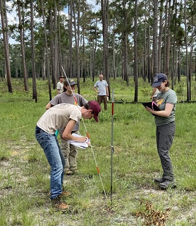
The summer began with training at Tall Timbers lead by Scott Pokswinski. Representatives from each location were in attendance to further learn about the process and meet the fellows involved. The two days of training consisted of field technique demonstrations and some of the data development. The fellows then departed from Tall Timbers in teams of two to their assigned sites. Over the next eight weeks the teams trekked through a variety of forest habitats, scanning plots. There were many challenges encountered, ranging from the physical field work, such as maneuvering extreme topography or dense foliage, to the capabilities of the software, including misidentifying telephone poles as trees. It was because of these challenges that inquires have been made and aspects of the process have been improved. At the end of the fellowship program, the project accumulated data from 670 plots.
This interagency terrestrial LiDAR project aims to explore the potential of using terrestrial LiDAR as a plot surveying method. This new use of terrestrial LiDAR technology promotes an increase in monitoring efficiency, while expending less resources. The training required for the field aspect is very straight forward and can easily be learned by individuals without surveying or fieldwork experience. Possible products from these scans include basal area, height to live crown, timber volumes, and fire fuels data. The project is also working towards machine learning to identify fuel loads in LiDAR scans.
The resulting data should inform recipients of the state of the habitat. These outputs are predicted to benefit a variety of interests, especially those related to management. These new techniques may be a way to monitor a habitat’s condition before and after a treatment or natural event. As conditions are better understood and documented through LiDAR, there should be better representation of habitat objectives and what steps should be taken to accomplish objectives including applications for prescribed fire planning and implementation.
The next steps for the project will be processing the data from the plots and extracting useable results. These results will be beneficial in habitat decision making and monitoring, leading to more strategic habitat conservation efforts.
The project would like to thank the fellows for their dedication this summer. The support provided from St. Marks NWR, Piedmont NWR, and the Francis Marion & Sumter National Forest ranger districts is greatly appreciated.


