Events

- This event has passed.
Tall Timbers and USGS Remote Sensing of Burned Area Symposium
January 25, 2023 @ 11:30 am - 1:00 pm
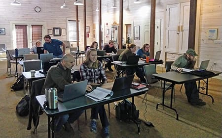
You’re invited to the Remote Sensing of Burned Area Symposium hosted by Tall Timbers and the U.S. Geological Survey (USGS) on January 25 at the E.V. Komarek Science Education Center.
Remote Sensing of Burned Area
Tall Timbers and USGS Symposium
In person (RSVP, lunch provided) and remote
11:30-11:40 Introduction and overview of the SE FireMap online fire inventory product. Joe Noble, Tall Timbers Research Station, Tallahassee, FL 11:40-12:00 Mapping burned areas from Landsat and Sentinel-2 imagery. Todd Hawbaker, USGS Environmental Change Science Center, Denver, CO 12:00-12:20 Contemporary (1984-2020) fire history metrics for the conterminous United States.
Melanie Vanderhoof, USGS Environmental Change Science Center, Denver, CO
12:20-12:40 Determination of burn severity models ranging from regional to national scales for the conterminous United States. Josh Picotte, USGS Earth Resources Observation and Science (EROS) Center, Sioux Falls, SD 12:40-1:00 Patterns of burning across the landscape using SE FireMap. Holly Nowell, Tall Timbers Research Station, Tallahassee, FL
Bios and Abstracts:
Todd J. Hawbaker, PhD, joined the U.S. Geological Survey as a research ecologist in 2008 and currently works at the Geosciences and Environmental Change Science Center in Denver, CO. His research with the USGS combines remote
When:
January 25, 2023
11:30 AM-1:00 PM
Where:
Tall Timbers Research Station E.V. Komarek Science Education Center, 13093 Henry Beadel Drive Tallahassee, FL 32312.
Contact for Zoom link, passcode, other info, and RSVP:
Joe Noble, jnoble@talltimbers.org oe Kevin Robertson krobertson@talltimbers.org.
Presentation abstract:
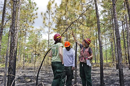
Monitoring spatial and temporal patterns of wild and prescribed fire ism critical for understanding fire patterns across both public and private lands. In the Southeast, fire is especially important to healthy native landscapes, to conserve listed and at-risk species, manage for wildfire risk, and minimize the need to conserve species through regulation. Here we present new efforts to improve the accuracy and completeness of burned area mapping over existing datasets by extending the Landsat Burned Area Algorithm to the Harmonized Landsat and Sentinel-2 dataset. The results of this effort will increase processing efficiencies and data accuracy. Most importantly, the new burned area products will inform Southeast FireMap and ultimately promote better decision-making to prioritize funding for staff, projects, training,
equipment, and allow fire partners to work smarter.
Melanie Vanderhoof, PhD, is a Research Geographer for the U.S. Geological Survey,
Geosciences and Environmental Change Science Center in Denver, CO. She uses remotely
sensed data to explore how ecosystems respond to mechanisms of change, such as climate
extremes and wildfire.
Presentation abstract: Remotely sensed burned area (BA) products are critical to support fire
modelling, fire policy, and land management. However, BA products often require further
processing before use, even when delivered at an annual time-step. Fire management across the
U.S. will benefit from comprehensive, spatially explicit fire occurrence data, delivered in a format
to facilitate their direct use by diverse stakeholders. We produced a suite of contemporary fire
history metrics from the Landsat BA products from 1984–2020 across the conterminous U.S. Fire
history metrics, alone, or combined with historical or target fire regime data, enables Landsat BA
data to help inform management of fire-dependent species and ecosystems, fire behavior and
emissions modeling, fire risk analysis, and prescribed fire planning, all elements that are sensitive
to fire history.
Josh Picotte has 15+ years of using field and remote-sensing based research for fire science
applications. His infatuation with fire (and fire science) began while working at Tall Timbers
Research Station. He is currently working at USGS EROS on the MTBS, LANDFIRE, and SE
FireMap projects.
Presentation abstract: We developed regression models that describe the relationship between
the Composite Burn Index (CBI) field-derived and remotely sensed assessments (i.e., derivations
of the Landsat derived Normalized Burn Ratio [NBR] index) of burn severity at different
ecologically relevant scales for the conterminous United States (CONUS). Overall, we found a
reasonable goodness of fit (R2) of 0.55 for the differenced NBR (dNBR) and a poor fit (R2 = 0.33) for NBR at the CONUS scale, and much better fits (R2 ≥ 0.75) for some smaller scale vegetation classifications. We will discuss how our simple decision tree framework allows a user to decide which scale and model may meet their needs to transform remotely sensed to on-the-ground burn severity metrics.
Holly Nowell, PhD, joined Tall Timbers in August of 2022 after completing a post-doc
at FSU where her studies included analyzing biases and uncertainties in the satellite
detection of fires in the Southeast United States, as well as modeling their emissions.
Her current work at Tall Timbers will focus on various aspects of SE FireMap including
assessing regional patterns and impacts of burning on ecosystem services, and
predicting and communicating the uncertainties in the burned area product.
Presentation abstract: This talk will show some preliminary research and discuss upcoming
research on how to use SE FireMap to conduct landscape-level analysis of burning trends across
the Southeast US region. Current areas of focus in the preliminary work include temporal trends
in burning on public vs. private lands in non-agricultural settings at a county level.