The context for the hatch in the Albany Area and the Red Hills was built last year when a good hatch provided for a rebound in the quail population across the region. The mild weather we had most of the winter provided for less than ideal hunting conditions, but it also kept the hawk migration to low numbers. Low hawk numbers, combined with good cover and native foods that persisted well into the winter, resulted in high quail survival and one of the highest carry over populations in the spring we have seen. As an example, this year’s spring population is considerably higher than it has been for several years, and is even higher than the fall population was in a couple of years (Figure 1).
Figure 1. Demonstrates how high the spring densities (quail/acre) were heading into the 2013 nesting season. Fall populations are based on our annual covey census and spring populations are derived from radio-telemetry survival estimates through the winter.
2013 hatch numbers so far can be characterized as solid, but not record setting, and very dependent on total rainfall received on an area. The positives include a high population of quail on the ground, continued high survival of adults, and decent number of cotton rats. The only negative affecting the region this year has been excessive rainfall in some areas, primarily the eastern Red Hills, which negatively affected chick survival; some plantations recorded 20-30 inches of rain in July! Our infra-red video work with broods also suggests that the chicks did better than anticipated, but brood sizes were diminished (click this link to see web video).
Nest and brood production per capita are both running above our long term average in Albany, but about average in the Red Hills. However, considering the good carryover and high spring population, per capita production this year will not have to be as high as it was in 2012, to produce good fall numbers. This is reminiscent of 2002, a record population year, in which individual production was not high, but population production was high because there were a lot of quail per acre!
Cotton rat populations are on the rebound and relatively high this summer, which correlates with higher adult survival. Adult survival this spring and summer remains high with 55-65% of the hens entering the nesting season remaining alive, and therefore available to continue contributing to the reproductive output. While we feel there was a solid early hatch, July numbers were less consistent (on some areas) as a result of rainfall. Yet, as mentioned above, a fair percentage of chicks did survive the deluges in July. The high survival of quail this summer means there are still a lot of quail available to nest in August and September. A strong late hatch would mean an above average quail population this fall in many areas.
Friday, October 25 • 7:30 AM – 1:00 PM
Nonami Plantation | Near Albany, Georgia
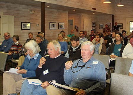
Nonami Plantation will host the 2013 Fall Field Day on Friday, October 25. Nonami is a 9,000-acres quail hunting plantation on the Flint River, just south of Albany. GA. The property is owned by Ted Turner and managed by Ray Pearce. It has a high Intensity quail management program and is one of the premier places in the Albany area.
At Fall Field Day, the outlook for the 2013/2014 quail hunting season will be discussed as well as other land management topics and the results from our recent quail research. A field tour of the property will be followed by lunch. Check-in and late registration begin at 7:30 AM. The field day adjourns at 1 PM.
Friday, November 1 • 7:30 AM – 1:00 PM Black River Plantation | Georgetown County, SC
Black River Plantation is a 1500-acre property in Georgetown County, South Carolina located on the outer banks of the Black River. This is an exquisite prop¬erty steeped in tradition with a magnificent plantation house listed on the historic National Registry and long-term habitat management goals of restoring native Longleaf Pine ecosystems. Recent land management efforts have focused on the conversion of Loblolly timber stands to native Longleaf and reclaiming forested uplands to quality bobwhite habitat.
Today, Black River is a prime example of how one can overcome challenges often faced outside the tradi¬tional quail belt to successfully produce bobwhite habitat. The dedication to bringing back bobwhites on Black River Plantation is obvious and unparalleled. Come join us as we discuss their management success and enjoy the rich tradition of Black River Planation!
With only a few short weeks left in 2013, our annual Membership campaign is drawing to a close. To support our research, conservation and education programs we have a goal of $425,000 for the year. With your help, we can reach that goal. Please consider renewing your membership today. You can do so securely online at: http://www.talltimbers.org/membership.html. If you have already done so, we hope that you might consider giving a gift of membership to a friend or colleague that you think would enjoy the benefits of becoming a member.
In this time of giving, we wish to give thanks to each and every one of you who have given of your time, talents and treasure to Tall Timbers in 2013.
Happy Holidays!
The Beadel House living room decorated for the holidays. Sunday, December 8 at 2:15 there will be a tour of the Beadel House and Jones Family Tenant Farm. Come see the rest of the house dressed for Christmas.
By Eric Staller, Land Manager & Natural Resources Coordinator
Due to common management practices of thinning forests, cutting fire breaks, blocking and others, Bahia grass that is planted on the woods roads for stability often ends up in the forest. Bahia grass can be invasive and out-compete many native grasses and forbs reducing the quality of ground cover. The goal of this project is to use selective herbicides to control Bahia, while maintaining as many of the native grasses and forbs. We applied 21 different treatments using 8 different herbicides. Spraying occurred in May, June and July of 2013 on three different sites. Five photo points within each treatment will be taken pre-application, at 3 months post, and 1 and 2 years post application. We hope to have a good understanding of the efficacy of these treatments by May 2014. The 3-month post application photos below suggest that each herbicide mix has an apparent threshold at which it can control Bahia grass, and that Escort® >1oz + >8oz Plateau®, > 16oz Clethodim®, and >24oz of Sethoxydim SPC® per acre appear to control Bahia grass.
At left, 1.3oz Escort® + 6.5oz Plateau®+24oz Sethoxydim SPC® + 21oz Surfactant + 36 gal H2O/acre 3 months post spray. At right, 24oz Sethoxydim SPC® + 21oz Surfactant + 32 gal H2O/acre 3 months post spray
Have you ever tried to count to 22,000? It’s not easy, and it’s the kind of task that most of us would avoid like the plague or at least try to accomplish using some convenient work around solution (let’s just skip everything between 2500 and 12,500, okay?).
But for a stalwart group of forest ecologists, this will be eleventh time such a count has taken place. And not only do they count to a mind-numbing level, they also measure all the items counted.
The study in question is the long-term census of trees on the Wade Tract. The Wade Tract is listed as a National Natural Landmark by the National Park Service and has been called a “…national treasure…” by noted author and Harvard-based ecologist E.O. Wilson.
In addition to being the only longleaf forest recognized as a national landmark, the Wade Tract also is the only old-growth longleaf tract that is protected in perpetuity and dedicated to long-term research, and it’s these virtues that make the tract truly stand out.
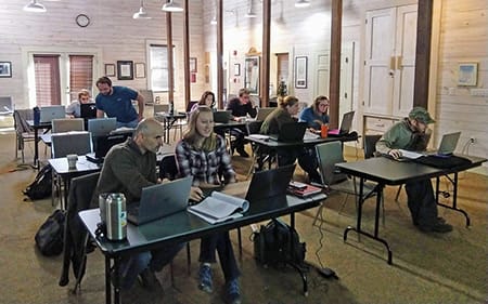
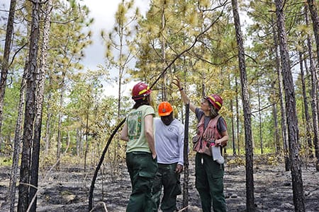
Beginning back in 1978, Dr. William Platt initiated a long-term study of the trees of the Wade Tract. Platt and his colleagues staked out a 130-acre plot within the tract and then proceeded to map and measure every single tree – all 22,000. Platt, an ecologist at Tall Timbers when the study was initiated, has since moved over to LSU, but he’s back this fall with colleagues conducting the thirty-fifth anniversary census of the Wade Tract.
“It takes about 2-3 minutes on average to measure each tree,” Platt notes. “So, we are able to work on 250-300 trees in a typical 10-hour day.”
“Over time, the census has helped to document the long-lived nature of longleaf pines as well as how pines, fire, storms, and lightning interact over time to shape the stand.”
“Of course some of the old giants fall each year but new recruits also come along, and one intriguing observation in this thirty-fifth anniversary census is the manner in which the clusters of young pines seem to be growing slowly outward along the edges,” Platt says. “It’s much like the cypress domes you find in Florida.”
The Wade Tract census has resulted in over 20 publications describing longleaf stand dynamics. The data also are used in many university classrooms to help teach about the analysis of complex spatial data. Each tree has been mapped as precisely as possible, so the interactions between growth, recruitment, and tree densities can be assessed in stunning detail for a living forest.
In the April 1952 issue of the Journal of Forestry, the Society of American Foresters' Committee on Natural Areas issued a request for locations of virgin forest types. They were beginning their search for specific undisturbed areas that might serve as a comprehensive base of knowledge about the natural developments within natural associations and to study the growth and change of these forests over time. Most of the original longleaf landscape was lost at this point, but, thanks to decisions made by the Wade family, collecting the type of long-term data needed for understanding century-old forests was made possible. Thanks to Platt and his colleagues, the possibility became reality.
Support for this thirty-fifth anniversary census has been kindly provided by the Arcadia Research Foundation in addition to staff and departments at Tall Timbers Research Station & Land Conservancy. Support for long-term research projects is one of the most important things we can do as an independent biological research entity.
The M-CORES program, which includes the proposed Suncoast Connector Toll Road in Jefferson County, passed through the Florida Legislature at breakneck speed with little review or analysis. Tall Timbers has a number of concerns given the potential for significant and wide spread impacts. These include fragmenting public and private conservation lands, robbing business from Main Street Monticello, impacting our rivers and other water resources, and making prescribed fire more difficult and costly.
Join us in asking the Jefferson County Board of County Commissioners to OPPOSE the Suncoast Connector toll road and its path through Jefferson County.
Take action now with our easy email form.
Send an email to all five Jefferson County Board of County Commissioners with one click!
Selected Publications authored by Wildland Fire Science staff.
Educating and guiding the next generation of fire researchers and managers is a key goal of Wildland Fire Science and a resource for testing new ideas in fire research.
Tall Timbers hosts the Prescribed Fire Science Consortium, a national network of researchers and managers who promote integrated research and management to advance next generation tools for fire practitioners. https://arcg.is/1DSjDT
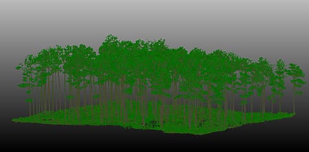
Working with partners in the Prescribed Fire Science Consortium, the program is building nexgen 3-D fuel beds using terrestrial LiDAR and novel sampling techniques to power new fire behavior models for prescribed fire managers. This work links to Tall Timbers work in wildlife habitat usage and ecological forestry.
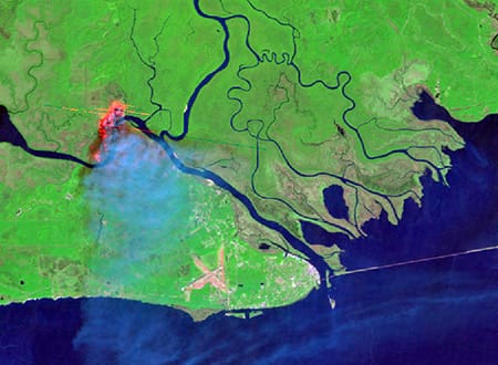
Tall Timbers is leading an effort to map fire regimes at the landscape scale. Staff work with numerous agencies to evaluate fire records and satellite imagery to build this critical conservation database. https://skfb.ly/6DqOY
We are linking physics and field observations to understand the fluid dynamics of fire behavior surface fire regimes. Our work combines field observations using advanced thermal imaging techniques, laboratory studies, and coupled fire-atmospheric modeling to help managers improve outcomes of managed fire regimes.
Burn prioritization modeling seminars and fire modeling tools are supported by Wildland Fire Science to train managers in the important planning stages of prescribed fires.
The conserved lands of the Greater Red Hills region are found on working, income-producing properties that support agriculture, forestry, and recreational hunting. These properties contribute $272 million annually to local economies and support 2,300 jobs. [link to Planning & Advocacy section] The landowners’ strong stewardship ethic preserves their working lands while replenishing drinking water supplies, protecting water quality, and providing wildlife habitat for dozens of rare and endangered species. Tall Timbers’ conservation easements on these working properties encourage landowners to retain their traditional livelihood by keeping farms in family ownership.
Home to world-class wild quail populations, the Greater Red Hills region contains the largest concentration of gamebird preserves in the United States. These preserves also support the largest community of Red-cockaded woodpeckers on private lands. Indicators of high quality habitat found here include the gopher tortoise, Bachman’s sparrow, fox squirrel, and many amphibians. Tall Timbers’ conservation easements identify and protect the critical habitats of these species.
The region also boasts outstanding aquatic resources. Large river systems, like the Flint/Apalachicola, Ochlockonee, and Aucilla, flow from Georgia and feed into the Gulf of Mexico to support some of the world’s most productive estuaries. Large disappearing sinkhole lakes, like Iamonia, Miccosukee, and Jackson, provide habitat for an array of aquatic species and migratory birds. Tall Timbers’ conservation easements protect these vital watersheds and wetlands that are the lifeblood for the ecological health of the region.
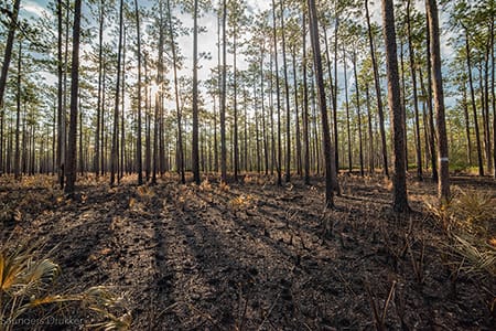
Once dominated by longleaf pine, our pine woodlands support abundant wildlife and local economies. These forests need prescribed fire to stay healthy. Herbert L. Stoddard and his associates Ed and Roy Komarek were pioneers in this emerging scientific field during the mid-20th century. Tall Timbers continues that legacy with applied research on prescribed fire and land management. Today, there is a tremendous need to expand prescribed fire use beyond the Red Hills to ensure ecosystem health and reduce wildfire risk. Additionally, Tall Timbers uses conservation easements to permanently protect private woodlands while balancing the need for economic return from selective timbering.
Tall Timbers hosts the premier fire technology transfer organization—the Southern Fire Exchange. This JFSP funded effort helps connect research to management through webinars, workshops, and support of the Prescribed Fire Science Consortium.
The Longleaf Legacy landscape prescribed fire burn team arm of Wildland Fire Science works directly with landowners and partners to effectively put fire on the ground and promote prescribed fire throughout the region.
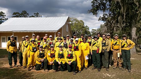
Staff and researchers support Federal fire training by serving as a cadre for NWCG training courses, ranging from basic wildland fire to advanced fire effects.
(PFTC) specializes in training fire fighters the principles and techniques of prescribed fire through practical hands-on experience. https://www.fws.gov/fire/pftc/
Private land owners are the largest source of prescribed fire in the country. These land owners and the culture of fire that was maintained by them during decades of suppression are a part of why Tall Timbers is a world-wide center for prescribed fire science. Workshops and fire training are a critical focus of the Longleaf Legacy Landscape Burn Team and our support of the Georgia Forestry Commission Prescribed Fire Center in Marion County.


 The study in question is the long-term census of trees on the Wade Tract. The Wade Tract is listed as a National Natural Landmark by the National Park Service and has been called a “…national treasure…” by noted author and Harvard-based ecologist E.O. Wilson.