Tall Timbers Develops a New Tool for the Conservation of a Rare Species
By Rob Meyer
In an age of rapid species decline, wildlife biologists must develop ways of re-establishing species to areas where they have gone extinct. Wildlife reintroductions are an increasingly necessary tool for maintaining our natural species diversity. The Stoddard Bird Lab specializes in this technique and has spearheaded successful reintroductions of red-cockaded woodpeckers and brown-headed nuthatches. But can we do it with a rare butterfly?
An adult frosted elfin butterfly. Adults are about 1” tall.
To answer this question, Dave McElveen and I, Tall Timbers researchers, are studying the life history of the rare frosted elfin, a fire-dependent butterfly of sandhills longleaf pine ecosystems. The elfin has been extirpated from large portions of its range in the eastern US, but our local population in the Apalachicola National Forest (ANF) is healthy. This gives us an opportunity to work with elfins without much risk of harming the population. Re-introduction has never been done for frosted elfins, but we set out to learn the if and the how.
Butterflies have four life stages: egg, caterpillar (“cat”), pupa, and adult. For elfins, we thought relocating caterpillars had the best chance of success with the least impact on the “donor” population. Specifically, moving older, larger caterpillars that are just a few days from becoming pupae. This way, the cats were free to choose where they wanted to spend the next nine months as a pupa instead of us deciding for them.
Frosted elfin caterpillars grow to about ¾” in length
Frosted elfin caterpillars are well camouflaged when feeding on their host plant, sundial lupine.
But how could we keep track of our relocated cats among all the undergrowth and from among all the other cats present? We needed a way to unequivocally identify them. The answer: hot pink fluorescent powder! The powder has been proven safe for caterpillars and is environmentally friendly. So, we gave it a try.
We powdered and relocated 20 cats from 3 different sites within the ANF. We checked on them for 6 days during the day and at night. Much to our delight they fed and developed normally. Also, they retained a lot of their powder even when rained upon. We were even able to follow 3 to their pupation sites thanks to the powder trail they left! This is only the second time pupation sites have been recorded for this species.
Putting fluorescent powder on a caterpillar.
Rob using UV flashlight and glasses at night to spot powdered caterpillars.
Two ¾” frosted elfin caterpillars under UV light at night: with fluorescent powder(left) and without (right).
Our translocation worked well but much more remains to be understood about how to restore habitat conditions for the elfin before we can return them to where they once were. For now, at least, we have a new tool ready for the next big move in the long-term conservation of this species.
Journey of a frosted elfin caterpillar from its last feeding site (on left) to pupation site (on right).
Powdered caterpillar beginning to pupate in soil.
Frosted elfin pupa (~3/4” long). Frosted elfins spend 9 months of their life in this stage as they transform into an adult.
Albany Quail Hunting Lands Create Jobs & Support Local Businesses
By Neil Fleckenstein
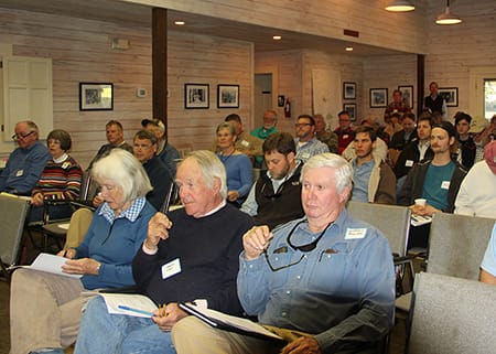
A post card from Radium Springs in 1947 proclaimed: “Albany, the world’s greatest paper shell pecan center, is also the bird dog capital of the world, and the mecca for sportsmen in this field.” While much has changed since 1947, the Albany region, along with the Red Hills, continues to be a destination for quail hunters. That said, it wasn’t until Tall Timbers completed the first economic impact analysis of the region’s quail lands in 2014 that we fully understood the extent of the economic impact and job creation associated with the region’s quail lands. Late in 2019, in conjunction with the Center for Economic Forecasting and Analysis, Tall Timbers surveyed the owners of 295,000 acres of high-quality quail lands to gather data for the second economic impact analysis of Albany region quail properties.
The 2019 analysis revealed that the total economic impact of Albany region quail hunting properties in 2019 was over $145 million. This is a 16% increase compared to the results from our earlier study. Albany region quail lands create or support over 1,160 direct and indirect jobs (a 32% percent increase over the 2014 study) and generate $56 million in labor income. Importantly, owners and managers of these hunting lands shop locally for many of their needs. As an example, they collectively operate nearly 300 tractors and other pieces of heavy machinery and 300 work trucks and ATVs, most of which are locally purchased, leased and serviced.
While Dougherty County received the largest share of the economic pie, with over $73 million in local economic impact and 459 direct and indirect jobs, significant benefits were spread across a dozen other rural counties, including those shown below.
County
Local Economic Impact of Albany Region Quail Lands
Total Labor Income from Albany Region Quail Lands
Direct and Indirect Employment from Albany Region Quail Lands
Dougherty
$73.7 million
$29.1 million
459
Baker
$16.8 million
$8.4 million
139
Lee
$8.8 million
$3.8 million
85
Decatur
$7.0 million
$2.8 million
58
Worth
$5.8 million
$1.6 million
109
Other Counties
$33.4 million
$11.1 million
314
Total
$145.5 million
$56.8 million
1,164
Clay Sisson, the Albany Quail Project Director for Tall Timbers, explained: “The benefit these properties provide by protecting our natural resources, traditional rural land uses, and overall quality of life in the region has long been recognized. These survey numbers reveal just how important they are to the area economically as well; something all of us that live here benefit from.”
Albany region quail hunting lands are truly a vital asset to the regional and local economies. At the same time, these properties provide bountiful supplies of drinking water, protect the quality of our water supply, and provide habitat for many imperiled wildlife species. Tall Timbers believes that working collaboratively with landowners, policy makers, and the business community is essential to sustain the vital economic and ecological benefits of Albany region quail lands for generations to come.
A BIG THANK YOU to our generous sponsors, bidders and supporters for participating in the virtual Kate Ireland Auction! Our team at Tall Timbers was blown away by the support of our loyal patrons from all parts of the country. Your donations provide critical funding for Tall Timbers’ mission. Thank you, friends of Tall Timbers, for your continued support; we hope to celebrate our mission with you in person next year!!
Toll Road Enters New Phase; Tall Timbers Seeks Strategic Changes
By Neil Fleckenstein
The Florida Department of Transportation (DOT) toll road project that threatens the Red Hills region, officially known as the Multi-Modal Corridors of Regional Economic Significance, entered a new phase on November 15, 2020, when the task forces submitted their final reports to the Legislature and the Governor. Throughout the 16-month task force process, Tall Timbers and our conservation partners provided research to the task force, DOT, and the public on critical topics including the potential fiscal impact of the project, potential negative affects to vital natural resources and conservation lands, and vulnerability of the Big Bend region to a changing climate and rising sea levels. View these reports on our website. for updates and opportunities for public input.
We also worked collaboratively with task force members to ensure important recommendations were included in the final report. Tall Timbers, 1000 Friends of Florida and many other conservation organizations helped to inform and educate the public about the toll road proposal and encourage public input throughout the process. As a result of Tall Timbers efforts, members of the public sent more than 2,000 emails to DOT, local county commissions, the regional transportation planning organization, and the Legislature.
What comes next?
The next phases in the planning process are the Alternative Corridor Evaluation (ACE) and the Project Development and Environment study (PD & E). The ACE will include analysis of a range of potential corridor route alignments, potential environmental impacts, and analysis of the engineering feasibility of these routes. The PD & E will include a deeper dive into the economic, environmental, and social impacts of feasible project alternatives evaluated in the ACE. The “no-build” alternative is a potential option in the PD & E analysis.
Empty US HWY 19
What will Tall Timbers be working on now?
The next phase for Tall Timbers involves working closely with the Legislature to remove Jefferson County as the stated terminus of the toll road. This will provide DOT and project engineers the needed flexibility to fully evaluate alignments along the I-10 corridor. Another focus will be removing the Legislatively-mandated construction start and completion dates. This will allow adequate time to demonstrate if there is actually a transportation need for the project; assess potential impacts to natural resources, conservation lands, and rural communities; and assess the fiscal impact of this multi-billion-dollar project. Both of these recommendations were included in the task force final report at the urging of Tall Timbers.
Tall Timbers will also continue our robust outreach and education efforts to ensure our members, the conservation community, and the public are informed about the next phase of the project, key issues of concern, and opportunities to participate in the planning process to ensure their voices are heard.
Timing
The Alternative Corridor Evaluation and the Project Development & Environment study will take approximately two years. With fewer opportunities for public participation compared to the task force process, this next phase will require vigilance by conservation organizations and the public to ensure that public and private conservation interests are protected from threats posed by the Suncoast Connector toll road. We will continue our work to keep you up to date on strategic opportunities for public input.
More on the Suncoast Connector Task Force Report
Of greatest interest to Tall Timbers was the final report developed by the Suncoast Connector toll road task force. That report included a series of “high-level needs” identified by the Task Force including improving safety, mobility and connectivity through access to a high speed, high capacity transportation corridor; protecting and enhancing public and private environmentally sensitive areas; enhancing emergency management; improving economic and workforce development; and enhancing rural broadband access.
The report also included task force-developed “guiding principles” to serve as direction for the next phase of the project. These guiding principles include maximizing use of existing facilities before building new transportation alternatives; ensuring consistency with existing local, regional, and state transportation plans; building transportation corridors that accommodate multiple modes of transportation; promoting long-term resilience; and protecting the environment.
For additional information: Contact Tall Timbers Planning Coordinator Neil Fleckenstein.
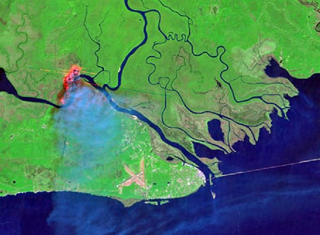
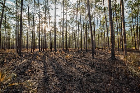
The COVID-19 pandemic has profoundly impacted lives around the world in countless ways. To help learn more about one of these many impacts, Tall Timbers is working with the NASA Earth Science Division through their Rapid Response program and the Forest Service Rocky Mountain Research Station, Missoula Fire Lab to measure and better understand changes in the use of prescribed fire during the pandemic. This research is part of an effort to help mitigate the negative consequences of the pandemic on the wildfire risk reduction benefits and wildlife habitat benefits of prescribed fire use.
In March 2020, as the pandemic began to spread in the United States, many organizations halted or reduced their prescribed fire programs to help maintain social distancing for those who conduct burns, and address uncertainty regarding the potential for smoke to aggravate COVID-19 symptoms. These changes overlapped with peak months for prescribed fire use in the Southeast. NASA satellites detected a 50% reduction in active fires in March 2020, and the reduction in fires has continued in the Southeast through Fall 2020. The pandemic is now in position to impact a second peak prescribed fire season for the Southeast in early 2021.
The graph below shows that spring 2020 had the fewest active fire detections on federal lands of any spring in the Visible Infrared Imaging Radiometer Suite (VIIRS) nine-year record. Likewise, NASA’s Moderate Resolution Imaging Spectroradiometer (MODIS)—a similar sensor but with a longer data record—showed spring 2020 fire counts were the lowest in a 16-year record.
However, the Red Hills region of southwestern Georgia and north Florida actually showed some increase in fire activity in spring 2020. It is believed that private lands managers in the Red Hills prioritized doing prescribed fires more quickly than usual, as uncertainty about COVID-19 and possible changes in burning restrictions in Florida and Georgia loomed.
In many areas a backlog of lands that need to be treated with prescribed fire already exists, and the federal government shutdown of 2018-2019, and the COVID-19 pandemic in Spring 2020, have both added to this fire deficit. Fire is a natural process, and without prescribed fire as a safe substitute, forest and grassland fuels accumulate and cause more destructive wildfires that can be negative for wildlife and society.
Tall Timbers worked with the Southern Fire Exchange on a webinar to share this data and host a panel discussion on creative strategies and success stories that have come out of fire management during the pandemic. The webinar was recorded and is available here.
The M-CORES program, which includes the proposed Suncoast Connector Toll Road in Jefferson County, passed through the Florida Legislature at breakneck speed with little review or analysis. Tall Timbers has a number of concerns given the potential for significant and wide spread impacts. These include fragmenting public and private conservation lands, robbing business from Main Street Monticello, impacting our rivers and other water resources, and making prescribed fire more difficult and costly.
Join us in asking the Jefferson County Board of County Commissioners to OPPOSE the Suncoast Connector toll road and its path through Jefferson County.
Take action now with our easy email form.
Send an email to all five Jefferson County Board of County Commissioners with one click!
Selected Publications authored by Wildland Fire Science staff.
Educating and guiding the next generation of fire researchers and managers is a key goal of Wildland Fire Science and a resource for testing new ideas in fire research.
Tall Timbers hosts the Prescribed Fire Science Consortium, a national network of researchers and managers who promote integrated research and management to advance next generation tools for fire practitioners. https://arcg.is/1DSjDT
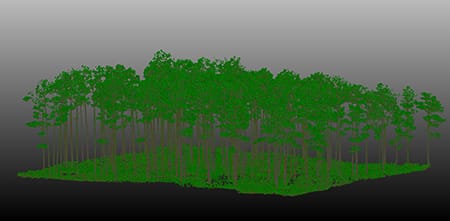
Working with partners in the Prescribed Fire Science Consortium, the program is building nexgen 3-D fuel beds using terrestrial LiDAR and novel sampling techniques to power new fire behavior models for prescribed fire managers. This work links to Tall Timbers work in wildlife habitat usage and ecological forestry.
Tall Timbers is leading an effort to map fire regimes at the landscape scale. Staff work with numerous agencies to evaluate fire records and satellite imagery to build this critical conservation database. https://skfb.ly/6DqOY
We are linking physics and field observations to understand the fluid dynamics of fire behavior surface fire regimes. Our work combines field observations using advanced thermal imaging techniques, laboratory studies, and coupled fire-atmospheric modeling to help managers improve outcomes of managed fire regimes.
Burn prioritization modeling seminars and fire modeling tools are supported by Wildland Fire Science to train managers in the important planning stages of prescribed fires.
The conserved lands of the Greater Red Hills region are found on working, income-producing properties that support agriculture, forestry, and recreational hunting. These properties contribute $272 million annually to local economies and support 2,300 jobs. [link to Planning & Advocacy section] The landowners’ strong stewardship ethic preserves their working lands while replenishing drinking water supplies, protecting water quality, and providing wildlife habitat for dozens of rare and endangered species. Tall Timbers’ conservation easements on these working properties encourage landowners to retain their traditional livelihood by keeping farms in family ownership.
Home to world-class wild quail populations, the Greater Red Hills region contains the largest concentration of gamebird preserves in the United States. These preserves also support the largest community of Red-cockaded woodpeckers on private lands. Indicators of high quality habitat found here include the gopher tortoise, Bachman’s sparrow, fox squirrel, and many amphibians. Tall Timbers’ conservation easements identify and protect the critical habitats of these species.
The region also boasts outstanding aquatic resources. Large river systems, like the Flint/Apalachicola, Ochlockonee, and Aucilla, flow from Georgia and feed into the Gulf of Mexico to support some of the world’s most productive estuaries. Large disappearing sinkhole lakes, like Iamonia, Miccosukee, and Jackson, provide habitat for an array of aquatic species and migratory birds. Tall Timbers’ conservation easements protect these vital watersheds and wetlands that are the lifeblood for the ecological health of the region.
Once dominated by longleaf pine, our pine woodlands support abundant wildlife and local economies. These forests need prescribed fire to stay healthy. Herbert L. Stoddard and his associates Ed and Roy Komarek were pioneers in this emerging scientific field during the mid-20th century. Tall Timbers continues that legacy with applied research on prescribed fire and land management. Today, there is a tremendous need to expand prescribed fire use beyond the Red Hills to ensure ecosystem health and reduce wildfire risk. Additionally, Tall Timbers uses conservation easements to permanently protect private woodlands while balancing the need for economic return from selective timbering.
Tall Timbers hosts the premier fire technology transfer organization—the Southern Fire Exchange. This JFSP funded effort helps connect research to management through webinars, workshops, and support of the Prescribed Fire Science Consortium.
The Longleaf Legacy landscape prescribed fire burn team arm of Wildland Fire Science works directly with landowners and partners to effectively put fire on the ground and promote prescribed fire throughout the region.
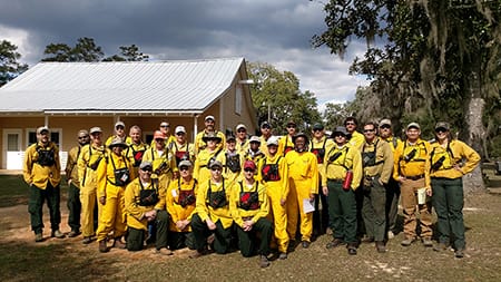
Staff and researchers support Federal fire training by serving as a cadre for NWCG training courses, ranging from basic wildland fire to advanced fire effects.
(PFTC) specializes in training fire fighters the principles and techniques of prescribed fire through practical hands-on experience. https://www.fws.gov/fire/pftc/
Private land owners are the largest source of prescribed fire in the country. These land owners and the culture of fire that was maintained by them during decades of suppression are a part of why Tall Timbers is a world-wide center for prescribed fire science. Workshops and fire training are a critical focus of the Longleaf Legacy Landscape Burn Team and our support of the Georgia Forestry Commission Prescribed Fire Center in Marion County.