Hog Havoc, a free mobile app developed by Tall Timbers, is now available
By Kim Sash and Kelsey Hoskins
“Resilient,” “destructive,” and “expensive” are a few words that come to mind when referring to the feral swine (hog) populations within the Red Hills region. The notorious animals have been introduced (accidentally and intentionally) to North America on multiple occasions over time, and have since developed into the perfect invasive species. These opportunistic omnivores are equipped for rooting, quick reproduction, and disturbing native wildlife like wild turkeys, white-tailed deer, and northern bobwhite. Their rooting behavior severely damages multiple ecosystems and agricultural crops, resulting in multimillion-dollar revenue losses annually. With populations having increased over the last 30 years, the Red Hills region now suffers from excessive damage caused by hogs. In response to such damage, property owners are looking for an easier way to pinpoint and mitigate feral hogs for quicker trapping efforts.
Hog Havoc, a free mobile app developed by Tall Timbers, is now available on all smartphone platforms, to allow the public to quickly provide wildlife managers with locations of feral hog populations. When you find live hogs or rooting on your property, you can mark each site with a GPS location in Hog Havoc, and also describe the habitat and estimated cost of any damage. The location of the site will be automatically and privately submitted to Tall Timbers biologists.
This information will help guide our current and future trapping throughout the region. Although our trapping project is limited to the Red Hills, documented hog signs can also be important for other areas. Please use the Hog Havoc app whenever you are, to help Tall Timbers track feral hog populations! The more data we collect, the greater ability we have to demonstrate the need for resources to help control this invasive species.
The Hog Havoc app can be accessed here: https://ttrsmaps.org/projects/hogs/. To get the app on a mobile device, simply click on the link and add it to your home screen. All of your data is private and not accessible to the public.
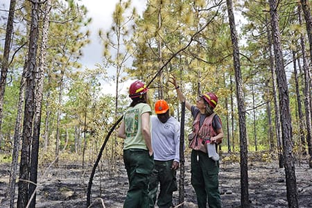
The Fire Ecology Program has been collaborating with Josh Picotte and other scientists at the U.S. Geological Survey, and two universities to publish a nation-wide assessment of our ability to map the severity of wildfires and prescribed fires using satellite remote sensing technology. Josh got his professional start at Tall Timbers in 2006, and since then has become a national leader in the field of remote sensing of burn severity. While at Tall Timbers, he focused on measuring burn severity, or the degree of change in vegetation and soil caused by fire, in plots on the ground, to calibrate data collected by satellites to map out burned areas in the southeastern U.S. For the current research, such plots have been compiled from around the country, totaling 5850 plots collected following 231 fires.
Josh Picotte (right) and Jason Drake (left) measuring a burn severity plot in the Apalachicola National Forest.
The specific goal of the study is to compare the accuracy of remote sensing of burn severity, using models that were developed at different spatial scales. So, one model was developed using all of the plots across the country using all fires, and others were developed with plots and fires within broad ecological regions, and others in smaller ecological regions, and so on. Models developed for local regions might be expected to be more accurate within those regions, but the tradeoff is that there are fewer plots to develop the model.
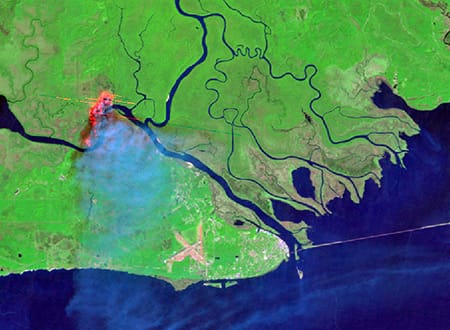
We found that, overall, models created for local regions are the most accurate, but there are exceptions, especially in regions where not many plots have been measured on the ground to calibrate the model. To help choose the best model for a particular fire, we created a “decision tree” to walk the user through the process of picking a model. Results of the research should provide an important advance in the ability of agency programs, such as Monitoring Trends in Burn Severity, to more accurately map burned areas. Maps of burned area and burn severity are important for many applications, including assessment of fire impacts on natural resources, creating national pollution emissions inventories, modeling the global carbon cycle to predict climate change, and monitoring the effects of climate change on trends in fire occurrence and effects.
Burn severity map of the River Fire in northern California, 2018, with redder areas indicating higher burn severity.
“Cheeseburger, cheeseburger, cheeseburger.” As I sit here at my kitchen table, I am increasingly annoyed at the persistent reminder that I’m hungry coming from outside. No, the Hamburglar isn’t creeping outside my window. Instead, the source of the noise is a Carolina Wren. This common species nests less than 20 feet from where I now sit, and is clearly interested in letting others know that this is where it’s at.
The Carolina Wren is one of the more common bird species out of the more than 330 species recorded from Leon County, Florida where I live. I’m lucky to live in a place with such high bird diversity, but diversity and abundance are two different things. Though diversity in my area is high, the overall abundance of birds around Tallahassee, and in places all over the country, continues to drop.
Limpkin. Photo by Heather Levy
The decline of birds in North America is no secret. Since the 1950s, numerous species have declined at such a rate that recent published research on the topic reached international audiences. Habitat reduction and fragmentation seem to be driving this downturn but, to truly assess landscape-wide declines, one must have a baseline to measure against. And, to actually reverse the decline, far more people need to be engaged with birds and their conservation. Recognizing these needs, Tall Timbers applied for and received a $5,000 Cornell Lab of Ornithology Land Trust Grant to carry out a project that would address both.
Tall Timbers, along with its partners, will help to fill in the gaps of bird distribution within Florida and Georgia, while engaging new audiences with bird conservation through the use of eBird. eBird is both a website and mobile app that allows anyone to log the bird species that they observe in a given area during a set period of time. Local Audubon chapter volunteers will teach private landowners the basics of birding and how to log their bird sightings on eBird, in conjunction with land trust staff conducting annual monitoring visits to conservation easement properties. In addition, these local Audubon chapters will have the ability to visit some of the most incredible private conservation land in their respective regions that are normally off limits, to enjoy and record the birds found in these under-surveyed, but critical, conservation lands.
Tall Timbers is partnering with Conservation Florida and Alachua Conservation Trust to connect with private landowners and their lands. Collectively, the three land trusts protect hundreds of thousands of acres that, in many instances, have been birded infrequently, if ever. In addition, the project will allow all three land trusts to partner with their local Audubon chapters that include Apalachee Audubon, Alachua Audubon, Orange Audubon, and West Volusia Audubon. Audubon volunteers will help support land trust staff in their efforts to connect the dots between landowners and their birds.
Partners will use webinars, the free eBird training course offered through the Cornell Lab of Ornithology, easement monitoring visits, and field trips to train both private landowners and/or interested members of the public in the use of eBird, binoculars, and other beginning birding tips. In addition to an opportunity to learn from Audubon volunteers joining land trust staff on property visits, landowners will also have the eBird training course available to them, along with the option for new field guides. Meanwhile, in addition to being able to bird normally-off-limits properties, Audubon volunteers will be gifted with advanced training courses offered by the Cornell Lab of Ornithology.
Scrub Jay. Photo by Heather Levy
This project brings measurable benefits to bird conservation in three direct ways. First, it directly records bird occurrences in areas where surveys are a challenge to conduct. Conservation easements, for instance, must have a baseline documentation report, but as any birder knows, one annual visit will not provide a comprehensive list of bird species on a given piece of property. Even if multiple visits do occur, birds come and go, so those less familiar with the appearance or sounds of a particular bird species may never record it. A Henslow’s sparrow may be easy to identify when it sits still, but that quick, brown bird that darts into the underbrush may be impossible to record if someone familiar with the call is not present. For these reasons and more, we believe that equipping private landowners with the means to record observations throughout the year, and connecting local bird experts with these properties will result in a much greater understanding of where declining birds live in Florida and South Georgia.
Another major benefit comes in the form of connecting people to birds. Until people feel personally connected to a problem, they are far less likely to take actions required to solve it. Private landowners will have the tools to foster connections with the bird life on their properties, building a deeper appreciation of their land along the way. These landowners may then help support efforts like eBird and/or local Audubon chapters, if their interest in bird conservation builds.
Finally, this project presents an opportunity to connect people. Land trusts will be able to engage with their landowner partners, while allowing landowners to take pride in the land they’ve worked to conserve, when they show it to either Audubon volunteers, the public, or both. Often, land trusts work in silos in their specific region but this project enables land trusts in a large region to work collaboratively on a single project that supports the respective mission of each land trust.
The connection between people in birds is central to slowing the rapid decline occurring in North American bird populations. While the land trusts involved in this project will remain committed to permanently protecting and managing habitats, this is not enough. More people must feel connected to the problem and must play a role in solving it. This project facilitates that process through the use of an innovative piece of technology and the seemingly simple, but too infrequent, act of building connections between different groups of people. Like a mixed flock landing in the same tree to feed, this project will enable different groups to come together around one resource, and then spread the seeds of conservation to new regions as the project takes flight.
If you are a landowner with an existing conservation easement through Tall Timbers or have an interest in developing one, you can get involved with this project. Please contact Peter Kleinhenz for more information.
On December 4, staff with the Stoddard Bird Lab will rise before dawn and attempt to see as many different species of birds as possible on Tall Timbers. By sunset, we hope to have 90 species on the list. Your pledge for the number of species seen will help us build a Motus tracking system to monitor bird migration in the region. In addition to providing data on species that have been fitted with a small Motus tag elsewhere in North America, we will be tagging species that move into our area in winter, to see where their northern breeding grounds might be and how quickly they get there.
We’ve had one of the best years ever in terms of the research accomplished, reports published, and new projects launched. All of this is made possible through the generous donations that you and many others provide. Help keep the great work going by making a pledge to BirdQuest today.
Tall Timbers Awarded 2020 Florida Preservation Award
Tall Timbers is pleased to announce that the John Russell Pope designed house at Dixie received a 2020 Florida Preservation Award for Restoration/Rehabilitation by the Florida Trust for Historic Preservation. The awards recognize people, organizations and communities who have worked to protect Florida’s extraordinary history and heritage. Award recipients were selected by a jury from around the state representing a variety of backgrounds and experiences.
“Although we are living in unprecedented times, it was important to us to continue our work recognizing excellence in historic preservation in our state,” said Florida Trust Board President Friederike Mittner. “Thank you to our award winners for all they do for preservation in our state.”
An oak allee leads to the front entrance of the Dixie House.
The 9,100-acre working/conservation property in Jefferson County is located in the heart of the Red Hills region, a distinct American landscape rich in natural and cultural resources. Under the Livingston family, the land became a highly regarded wild quail hunting preserve and one of the finest field trial venues in North America. The centerpiece of this grand estate is the 14,200-square-foot Neo-Classical Revival mansion designed in 1936 by John Russell Pope, one of the nation’s most prominent twentieth century architects. The Livingston residence was his only Florida-constructed design.
IFACS conducted a study of the historic paint colors in the Dixie House. The consultants exposed the original colors using the bullseye mechanical method which involves carefully sanding an exposure through all layers of paint until the plaster or timber substrate is reached. IFACS used a spectrophotometer to read the bullseye samples using the Munsell color standard for recording the results. Tall Timbers used IFACS’ detailed report to select paint for repainting the interior in original colors.
Thanks to the financial support from the State of Florida and significant private donations, Tall Timbers/DPR, Inc. has completed a three-phase restoration and rehabilitation of the historic house.
The expertise of Edwards Olson Architecture and Childers Construction Company ensured a high-quality final result, including exterior and interior finishes, a commercial grade kitchen, central heating and air conditioning, repaired plumbing, and life safety and accessibility upgrades.
In addition, the award recognizes the craftsmanship of International Fine Art Conservation Studios, Inc. (IFACS) in the restoration of the historic paneled rooms. IFACS also conducted a detailed historic paint analysis to determine the original interior colors of the building.
According to the IFACS paint study, the dining room had been coated with a rainbow of paint throughout the history of the Dixie House and has now been restored to its original neutral colors. The more muted tones highlighted the elegant trim, artwork, and furniture the Livingstons placed in the room.
The second and third floor rooms were suffering extensive paint failure due to poor surface preparation and lack of an HVAC system. Once the HVAC system was installed, the interior surfaces were repaired, prepped properly, and repainted in the historic paint colors as determined by IFACS. The natural green tone in this bedroom complements the landscape around the house.
The historic paneling in the living room had been poorly refinished at some point unknown to Tall Timbers, and it was dark and dingy. After detailed surface testing and research, IFACS restored the living room paneling and trim to its original finish.
IFACS conservators thoroughly cleaned and restored detailed wooden trim, including fireplace mantles.
IFACS Chief Conservator Mary Aldrich restores historic wood paneling in the Dixie House living room. Tall Timbers hired IFACS to study and restore the historic finishes of the living room paneling. IFACS also cleaned the historic paneling in the library, gun room, bar, and master bedroom sitting area. Additionally, IFACS developed instructions for future care of the paneling.
The restored venue will soon open to host scientific meetings and community events. According to Kevin McGorty, Land Conservancy Director, “the completion of this restoration project returns this unique country house to its rightful place as one of Florida’s architectural gems.”
The M-CORES program, which includes the proposed Suncoast Connector Toll Road in Jefferson County, passed through the Florida Legislature at breakneck speed with little review or analysis. Tall Timbers has a number of concerns given the potential for significant and wide spread impacts. These include fragmenting public and private conservation lands, robbing business from Main Street Monticello, impacting our rivers and other water resources, and making prescribed fire more difficult and costly.
Join us in asking the Jefferson County Board of County Commissioners to OPPOSE the Suncoast Connector toll road and its path through Jefferson County.
Take action now with our easy email form.
Send an email to all five Jefferson County Board of County Commissioners with one click!
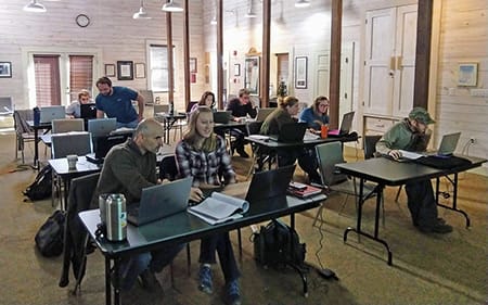
Selected Publications authored by Wildland Fire Science staff.
Educating and guiding the next generation of fire researchers and managers is a key goal of Wildland Fire Science and a resource for testing new ideas in fire research.
Tall Timbers hosts the Prescribed Fire Science Consortium, a national network of researchers and managers who promote integrated research and management to advance next generation tools for fire practitioners. https://arcg.is/1DSjDT
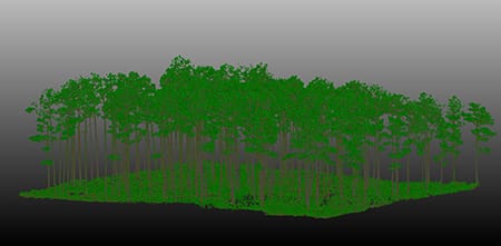
Working with partners in the Prescribed Fire Science Consortium, the program is building nexgen 3-D fuel beds using terrestrial LiDAR and novel sampling techniques to power new fire behavior models for prescribed fire managers. This work links to Tall Timbers work in wildlife habitat usage and ecological forestry.
Tall Timbers is leading an effort to map fire regimes at the landscape scale. Staff work with numerous agencies to evaluate fire records and satellite imagery to build this critical conservation database. https://skfb.ly/6DqOY
We are linking physics and field observations to understand the fluid dynamics of fire behavior surface fire regimes. Our work combines field observations using advanced thermal imaging techniques, laboratory studies, and coupled fire-atmospheric modeling to help managers improve outcomes of managed fire regimes.
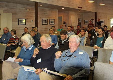
Burn prioritization modeling seminars and fire modeling tools are supported by Wildland Fire Science to train managers in the important planning stages of prescribed fires.
The conserved lands of the Greater Red Hills region are found on working, income-producing properties that support agriculture, forestry, and recreational hunting. These properties contribute $272 million annually to local economies and support 2,300 jobs. [link to Planning & Advocacy section] The landowners’ strong stewardship ethic preserves their working lands while replenishing drinking water supplies, protecting water quality, and providing wildlife habitat for dozens of rare and endangered species. Tall Timbers’ conservation easements on these working properties encourage landowners to retain their traditional livelihood by keeping farms in family ownership.
Home to world-class wild quail populations, the Greater Red Hills region contains the largest concentration of gamebird preserves in the United States. These preserves also support the largest community of Red-cockaded woodpeckers on private lands. Indicators of high quality habitat found here include the gopher tortoise, Bachman’s sparrow, fox squirrel, and many amphibians. Tall Timbers’ conservation easements identify and protect the critical habitats of these species.
The region also boasts outstanding aquatic resources. Large river systems, like the Flint/Apalachicola, Ochlockonee, and Aucilla, flow from Georgia and feed into the Gulf of Mexico to support some of the world’s most productive estuaries. Large disappearing sinkhole lakes, like Iamonia, Miccosukee, and Jackson, provide habitat for an array of aquatic species and migratory birds. Tall Timbers’ conservation easements protect these vital watersheds and wetlands that are the lifeblood for the ecological health of the region.
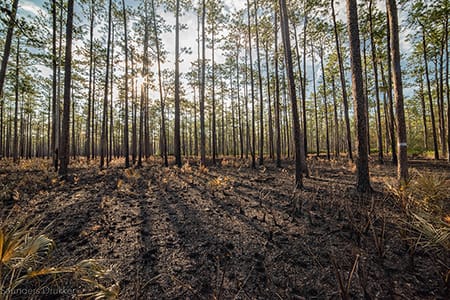
Once dominated by longleaf pine, our pine woodlands support abundant wildlife and local economies. These forests need prescribed fire to stay healthy. Herbert L. Stoddard and his associates Ed and Roy Komarek were pioneers in this emerging scientific field during the mid-20th century. Tall Timbers continues that legacy with applied research on prescribed fire and land management. Today, there is a tremendous need to expand prescribed fire use beyond the Red Hills to ensure ecosystem health and reduce wildfire risk. Additionally, Tall Timbers uses conservation easements to permanently protect private woodlands while balancing the need for economic return from selective timbering.
Tall Timbers hosts the premier fire technology transfer organization—the Southern Fire Exchange. This JFSP funded effort helps connect research to management through webinars, workshops, and support of the Prescribed Fire Science Consortium.
The Longleaf Legacy landscape prescribed fire burn team arm of Wildland Fire Science works directly with landowners and partners to effectively put fire on the ground and promote prescribed fire throughout the region.
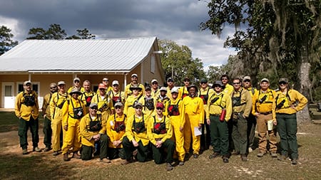
Staff and researchers support Federal fire training by serving as a cadre for NWCG training courses, ranging from basic wildland fire to advanced fire effects.
(PFTC) specializes in training fire fighters the principles and techniques of prescribed fire through practical hands-on experience. https://www.fws.gov/fire/pftc/
Private land owners are the largest source of prescribed fire in the country. These land owners and the culture of fire that was maintained by them during decades of suppression are a part of why Tall Timbers is a world-wide center for prescribed fire science. Workshops and fire training are a critical focus of the Longleaf Legacy Landscape Burn Team and our support of the Georgia Forestry Commission Prescribed Fire Center in Marion County.